Maps
Videos
Using Maps
http://videos.howstuffworks.com/hsw/27069-maps-and-coordinates-using-maps-video.htm
Mapping the Mountains
http://videos.howstuffworks.com/hsw/11880-mapping-the-earth-mapping-and-measuring-mountains-video.htm
Maps and Globes
http://videos.howstuffworks.com/hsw/17071-maps-and-globes-types-of-maps-video.htm
Games:
Alienz! Map Game
Map GeoTournament
US Capitals Map Game
Geographic Continent Map Game
Africa Map Game
South East Asia Map Game
USA Jigsaw Map Game
Crossword Map Game
USA & Canada Map Game
Latin America Map Game
Europe Map Game
Russia Map Game
Asia Map Game
Middle East & North Africa Map Game
http://www.maps.com/FunFacts.aspx?nav=FF#
Interesting Things to Know about Maps!
1. Maps are drawings that represent a place in the earth as seen from above.
2. People who make maps are called Cartographers
3. The 1st map was drawn on a small clay tablet by the Sumerians.(According to The Software Toolworks Multimedia Encyclopedia)
4. Early Egyptians drew maps to show property lines because the Nile River flooded the area every year and washed away the land markers.

5.Pirates used maps to find buried treasure.
To be able to use a map you need to learn about four things:


Compass-
You need to know where North, East, South and West are in order to follow directions
On most maps north points towards the top of the map.
Most maps use a compass rose

A grid reference is useful for identifying a place on a map. It is made up of four numbers that mark lines that cross.
Maps use symbols to stand for different things. A key explains what the symbols on the map mean.
The symbols can be pictures, words or shortened words.
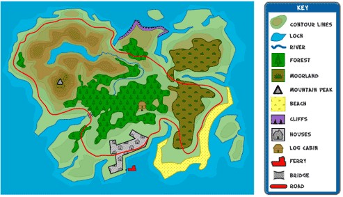
Map key from http://www.bbc.co.uk/scotland/education/sysm/landscapes/highlands_islands/mapskills/symbols/index.shtml#focus
Take a look at the different type of maps for the state of Michigan
Michigan Physical Map
Michigan Waterfalls Map
Michigan County Map
Michigan Cities and Roads Map
Michigan Rivers and Lakes Map
Michigan Elevation Map
Highest Point in Michigan Map
Michigan Geology News
Michigan Satellite Image
Michigan City Satellite Images
http://geology.com/state-map/michigan.shtml
Scale
Maps can’t show things the size they are in real life so they use scale to make things smaller. Different scales are useful for showing different things on a map.
Let's Practice these big ideas
Let's identify places on a map image of the world at night .
It is taken from space!
A map is a drawing of a picture of the earth as sen from above.
Can you see the continents on the Earth at Night map
Can you find Michigan?
Let's look at Earth at Night work sheet.
Can you find the names of the ten large cities highlighted on the work sheet?
More Mapping Ideas
Treasure Maps:
Students can also make their own treasure maps.
Literature:
Have students draw a map of the route a character takes in a book. (Little Red Riding Hood's trip to Grandmothers, Hansel and Gretel's journey through the woods, etc.)
What to learn more??
See a resource on the NASA Web site, The Blue Marble. Discuss what features of Earth those other maps show that cannot be seen in the Earth at Night map.
Treasure Maps

http://www.britishcouncil.org/kids-stories-treasure-map-popup.htm
Thanks to:
http://computerkiddoswiki.pbwiki.com/